
The Global Positioning System (GPS) is funded by and controlled by the US Department of Defense (DoD). While there are many thousands of civil users of GPSs worldwide, the system was designed for and is operated by the US military. The GPS provides specially coded satellite signals that can be processed in a GPS receiver, enabling the computing of the object's position, velocity and time.
The nominal GPS constellation consists of 24 satellites that orbit the earth in 12 hours. There are often more than 24 operational satellites as new ones are launched to replace older satellites.
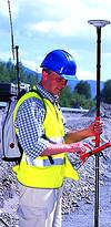
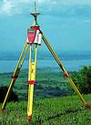
The Leica Geosystems GPS receiver SR530 is a 24-channel, dual-frequency receiver with Satelline-3AS modems from Satel for highest accuracy and on-board RTK. RTK (RealTimeKinematic) means measuring the position with centimetre accuracy in realtime. The system includes a reference station and a rover. The reference (base) station sends position corrections data to the rover. Because the base is set at a known point, it calculates corrections (positioning errors) from satellite data. The rover is normally a few kilometres away from the base, so corrections are the same to the base and rover.

The Satelline modem is a good choice for datalink between the base (Satelline-3AS Epic, 10 W) and rover (Satelline-3AS). The Base datalink transmits data at one second intervals. The Satelline modems are included in the menu so the operator can use them as the default datalink. The surveyor can also change the frequency using the SR530 sensors software.
The Finnish Communications Regulatory Authority provides frequencies for use in the Satelline. If customers have stationary reference stations at the Satelline frequency they must request and get permission from FCRA. Sometimes it happens that there are other systems at the same or almost same frequency near the surveying area. This could cause misunderstanding or errors in the field. Leica's software can handle this problem. The surveyor can change the frequency temporarily from the control panel. This is a great help to engineering and consulting companies who survey all over the country using GPS.
The rover calculates the position with an accuracy of one centimetre. Leica uses the ClearTrack technology in System500 receivers. This means fast and reliable positioning, with high accuracy. In normal conditions it takes only a few seconds to get accurate 3D coordinates. Leica Geosystems has made a housing for the Satelline-3AS modem. There are no cables or wires, the housing is fixed directly to the sensor's port. Although it may sound unimportant that there are no wires, those who have measured in a forest or some other difficult area know that cables are usually the first to break and if there is no extra cable available, it costs a lot to find a new one and to go surveying again. Difficult measuring areas are normally the places where GPS is needed the most.
One large customer, the National Board of Survey (NLS), has 60 System500 GPS and Satelline modems. Many municipal surveying departments use Leica with Satelline. One customer surveys up to 30 km from base with Leica GPS and a Satelline modem.
For more information contact Satel SA, 011 887 2898.

© Technews Publishing (Pty) Ltd | All Rights Reserved